
Chinatown Food Systems
Proposal / Public Programming / New York USA / Valerie Imbruce / Mary Miss / City as Living Lab
Invited by Mary Miss / City as Living Laboratory, S. Fan collaborated with economic botanist Valerie Imbruce (author of From Farm to Canal Street, Chinatown's Alternative Food Network in the Global Marketplace) to map the Manhattan Chinatown food systems' impacts on the hinterlands and on the urban realm: namely street and sidewalk congestion, and equitable and sustainable uses of the public realm.
The project included an online story map and public walks that mapped current public/private, rural/urban, Chinatown/non-Chinatown boundaries. It also used mapping as a projective act, with three projections generating conversations about the food systems' impacts, challenges, and solutions:
1. MULTIPLIED GROUND PLANE
2. DYNAMIC CURB MANAGEMENT
3. INFRASTRUCTURAL LINING
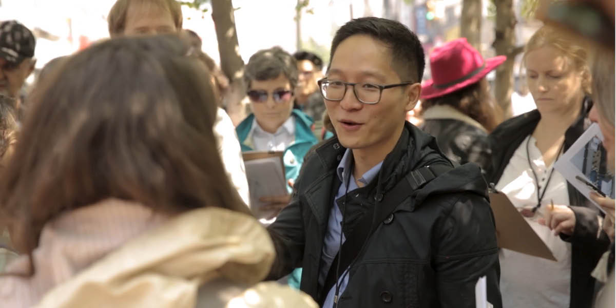
The walks drew one of the largest crowds in CALL's history. The project's next steps include further community outreach, research, and mapping.
Thanks to Isaac Telio and Harrison Peck (Arup).
Media:
Next City: "Why Chinatown Is So Delicious, and Why It Might Not Be So Forever" (May 16, 2019)
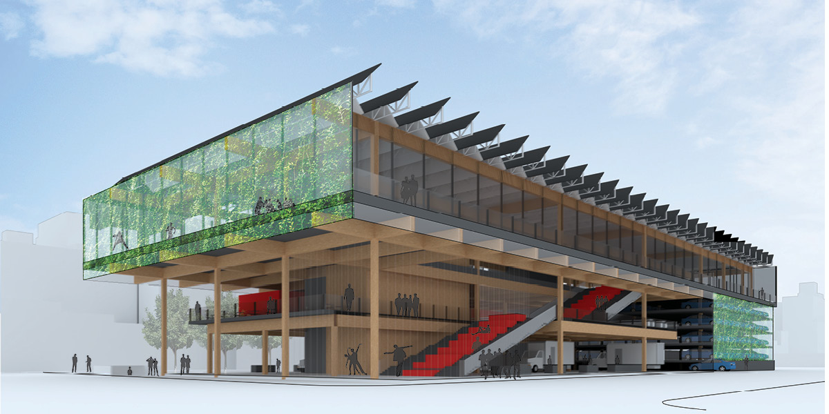
1: MULTIPLYING THE GROUND PLANE. To relieve congestion and maximize public open space, the ground plane of S. Roosevelt Park is multiplied to create platforms for a Food Street Vending Market, Food Hall, Automated Parking, Performance, and Recreation Center. Generous vertical circulation doubles as seating for eating or watching a performance, a cost effective chain link enclosure serves as an armature for greenery, and a sprinklered cross laminated timber structure minimizes the construction's carbon footprint.
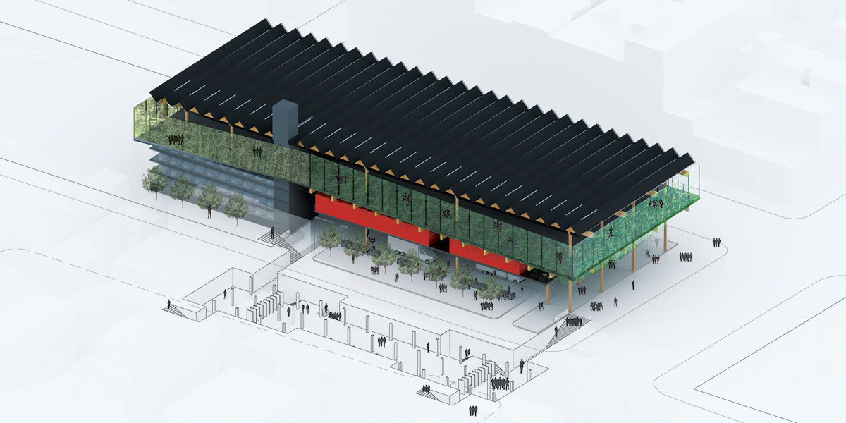
1: Multiplying the ground plane provides an open covered street market, relieves congestion with an expanded Grand Street subway station, and generates revenue through automated parking.
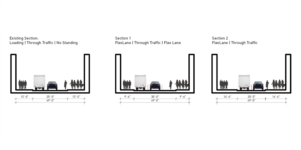
2: DYNAMIC MANAGEMENT: Mott Street's two blocks S of Grand Street are often packed with pedestrians, shoppers, and deliveries patronizing and servicing the food retailers and food stoop side stands. Unlike the current curb management of signs and markings, which are static, often confusing, and inconsistently enforced, new dynamically managed Flex Lanes are inserted which would designate specific activities at specific locations and times based on previous use and demand.
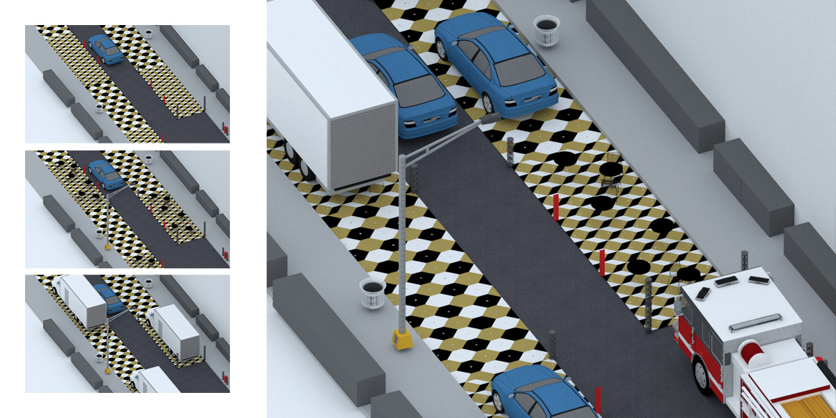
2: Sensors and cameras gather data to model, predict, and efficiently manage the Flex Lane, which could be designated for any combinations of through-traffic, loading, pedestrians, seating, and/or vending. Audio and visual signals, as well as LED embedded pavers would communicate which uses are permitted, and enforcement and processing of violations could be fully automated.
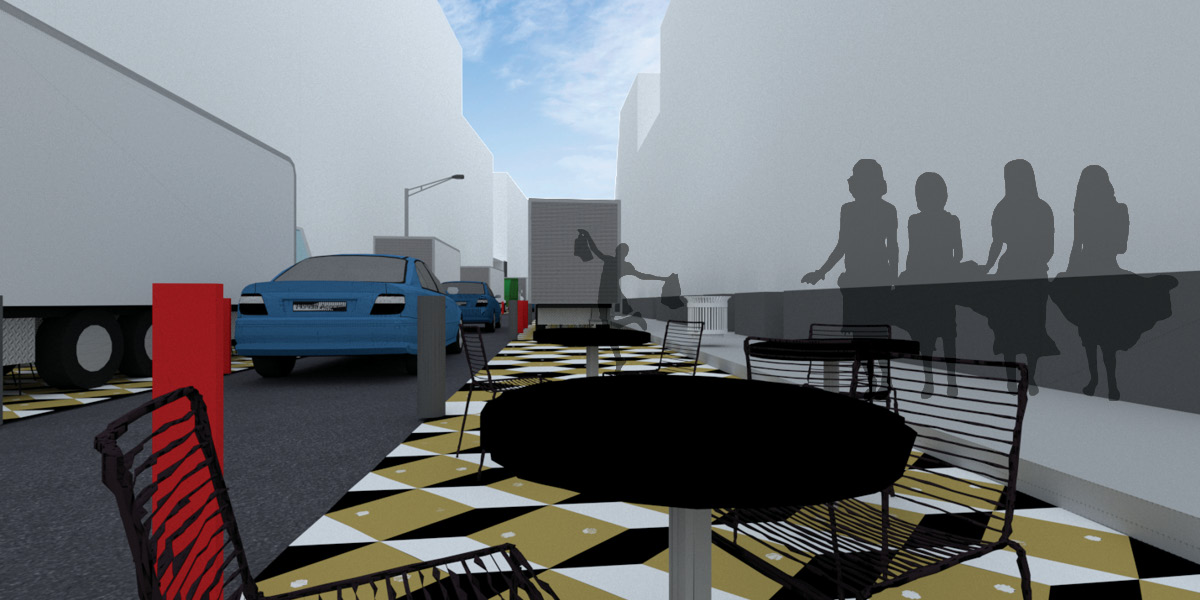
2: Businesses and street vendors rely on foot traffic, and a dynamically managed curb space could increase foot traffic without increasing congestion with a pleasant pedestrian environment.
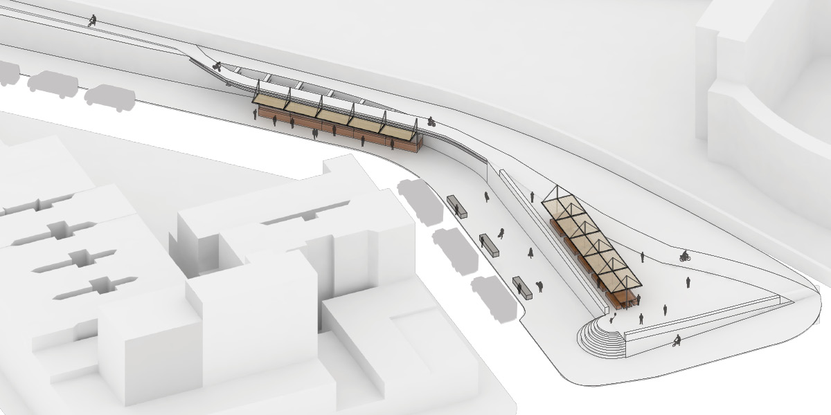
3: INFRASTRUCTURAL LINING. At the base of the Manhattan Bridge and an existing greenmarket, there has been some traction by community organizations to create an affordable street food/night market with appropriate infrastructure. Serving residents and attracting visitors, the market would be curated and managed by a non-profit business incubator, who would lease carts/stalls at subsidized rates to support new local food businesses.
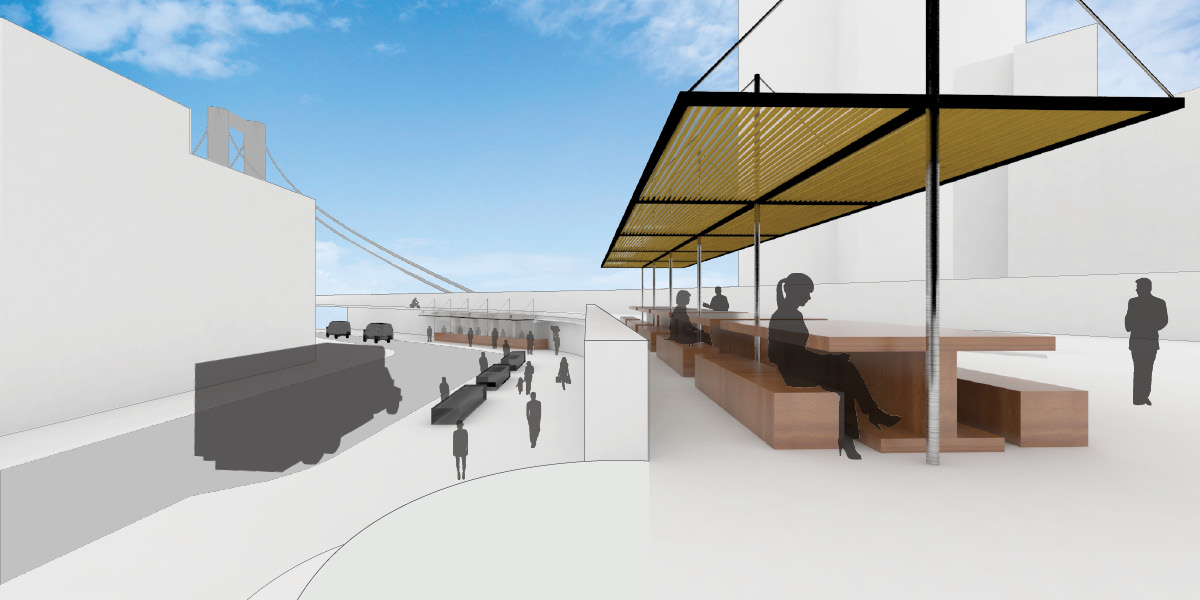
3: The projection extends the existing bike path structure, and envisions canopies to provide cover from the elements while creating a landmark that ties into the forms of the iconic Manhattan Bridge.
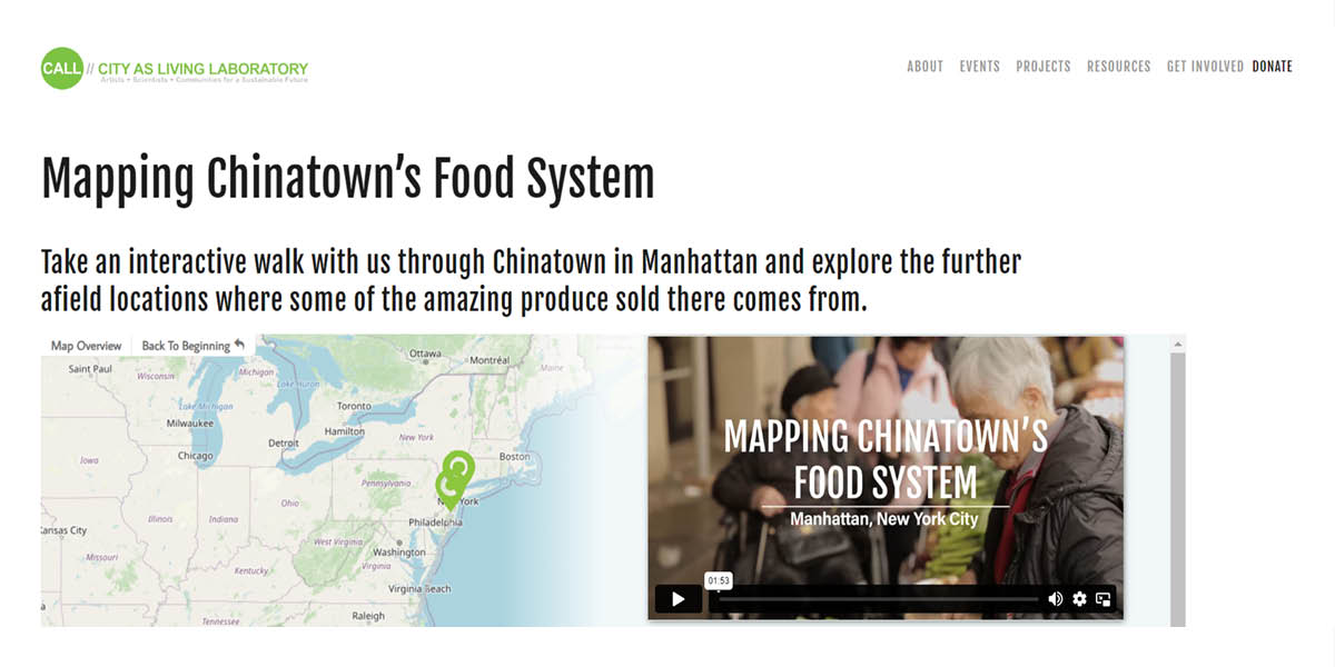
Online story map
Walk led by S. Fan and Valerie Imbruce.